Dienstag, 31. März 2009

EF8M - Contest-station from Gran Canaria

EF8M was a multi operator entry in the CQ WPX(working all prefixe)Contest 2007 and in the CQWW contest 2007 from a russian crew. Members of the team: Valery RD3AF, Alexandr RZ3AZ, and Yuri RA9JR. DL5AWI received the cards via the manager RX3DU.
The WPX contest is based on an award offered by CQ Magazine for working all prefixes. Held each year on the last weekend of March (SSB) and May (CW), the contest draws thousands of entries from around the world.
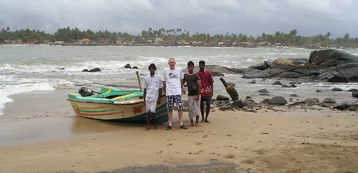
Gran Canaria is one of the Canary Islands in the Atlantic Ocean. Capitol and biggest city is Las Palmas de Gran Canaria in the north of the island.
The touristic centres Maspalomas and Playa Inglis in the south are very popular. The warm climate is nearly constant. The weather is usually sunny and dry because it is near the Sahara Desert.
Coves and beaches, impressive cliffs, hidden corners, magnificent mountains, stunning craters, subtropical vegetation and natural reserves are some of the many natural delights, which mark Gran Canaria’s personality … so very diversified and unique!

Donnerstag, 26. März 2009

FJ/DJ2VO - Saint Barthelemy

OM Juergen, DJ2VO was on St.Barthelemy in May 2008. The location was the Hotel "Le Village" in St.Jean. This island is part of the French West Indies in the Caribean Sea.
The equipment was a vertikal antenna and power 100 watts only. Juergen confirmed the contact by QSL-card via the DARC bureau.Saint-Barthelemy located among the Leeward Islands. Its land area is 21.0 qkm (8.1 sq. miles). Administratively, the whole island of Saint-Barthélemy is a French Overseas Collectivity, until recently part of Guadeloupe and is part of the European Union.
The island is also known as Saint Barth.
St Barth has long been considered a playground of the rich and famous and is known for its beautiful pristine beaches.
It is an extra entinity by amateur radio with own DXCC status.
73 de Gerd DL5AWI

Freitag, 20. März 2009

R6SE - on Air from Elbrus Mountains

For the first time in the russian history, radio fans have spent the whole series of the distant officially registered short-wave communications from the highest top of Europe - mountains of the Western Elbrus. The connection between R6SE and DL5AWI was from peak "Day of the athletic" with an altitude of 3950 meters.The mountaineering is a check of limits of physical and psychological possibilities of the person.
Every person would like to feel as a pioneer - if not Columbus so Magellan, to subdue new top or to open for radio fans of the world a new corner on our planet.
Preparation for radio expedition has begun in the summer 2005 and included physical, technical and climbing components. The special attention was given to physical preparation, - run on 10-12 km became an indispensable condition for applicants for inclusion in the command of climbers-radio fans.
Technical training consisted in a choice of radio equipment and antenna-feeding devices for a radio communication on short waves which would have sufficient capacity and the minimum of weight.
The equipment:
base camp - ICOM-746, 3,5-7 MHz on 10 meter mast from separate knees, G.P. 14 MHz, 1 kw generator from Honda, a power unit 12volt 20А and computers.
mountain tops - ICOM-706 MK2G, the accumulator 12V 12A, self-made aerial G.P. on 14 MHz and easy 50-Ohm 10 metre cable. The weight of all radio amateur equipment was about 12 kg.

Donnerstag, 19. März 2009

4O3T - Montenegro

Montenegro declared the independence on June 3th 2006. You can see the changes at my log extract.
This special callsign used by the SKY-Contest_Club from the 4O3A contest location. QSL manager for this card was Diemar DL3DXX.The frontpage of the QSL shows Sveti Stefan, a 15th century fishermen`s village, that has been transformed into a hotel now.
Montenegro (meaning "Black Mountain" in English) is a country located in southeastern Europe. It has a coast on the Adriatic Sea to the south and is bordered by Croatia to the west, Bosnia and Herzegovina to the northwest, Serbia to the north, Kosovo to the east and Albania to the south. Its capital and largest city is Podgorica.
Montenegro is a member of the United Nations, the Organization for Security and Co-operation in Europe, CEFTA, Council of Europe and Montenegro is also a founding member of the Union for the Mediterranean. It is also a potential candidate for membership in the European Union and NATO.
A sovereign principality since the Late Middle Ages, Montenegro saw its independence from the Ottoman Empire formally recognized in 1878. From 1918, it was a part of various incarnations of Yugoslavia.

Montag, 16. März 2009

European Football (Soccer) Championship 2008

This was a large operation between April 26th and June 30th in 2008 to celebrate the European Football Championship UEFA in Austria and Switzerland.These amateurradio operations was from the following stadiums and places:
Vienna........Erbst-Happel-Stadion
Innsbruck.....Tivoli-Stadion
Klagenfurt....Wörthersee-Stadion
Salzburg......EM-Stadion Wals
Basel.........St.Jackobs-Stadion
Bern..........Stade de Suisse Wankdorf
Geneva........Stade de Geneve
Zurich........LetzigrundThe special QSL-cards was printed and dispatched by www.GlobalQSL.com
73 de Gerd DL5AWI

Dienstag, 10. März 2009

OJ0/OG3A - Market Reef, Finland

This was an expedition from Pasi, OH3WS with the call OJ0/OG3A, which I received via the DARC bureau.
He is a volunteer of the Finnish Lighthouse Society. She is working to save the unique Market lighthouse on the border of Finland and Sweden, ten kilometers from the nearest neighbours. The unique lighthouse from 1885 has stood empty for 30 years waiting for new ideas of use. This Society invite every lighthouse lover in the world to participate. You may order your Market Reef stamps with the special Market Reef cancellation today. Read more about this hereThe video is from another expedition from swedish HAMS. The video shows Eric, SM1TDE when operated CW (telegraphy)
Market Reef, as it is called among three million radio amateurs around the world, is a separate DXCC-country. Market Reef used to be one of the world's most desired countries among radio amateurs due to its special status and inaccessibility. Usually there are one or more Amateur Radio expeditions to the island every year, weather permitting. During these expeditions tens of thousands of radio contacts are made with the entire world. At high seas, landing is only possible with a helicopter. All radio activity on the island is by visitors on DX-peditions.

Samstag, 7. März 2009

RI1NU - Valaam Island, Russia

This was an expedition 2005 from members of the Russian Robinson Club(RRC) Victor, RN1NU and Valery, RN1NC.
The QSL card came in via the DARC bureau.
The Valaam Monastery is a stauropegic Orthodox monastery in Russian Karelia, located on Valaam, the largest island in Lake Ladoga, the largest lake in Europe.
First Mentions about the monastery on the island of Valaam are dated back to 10th century. It`s founders are supposed to be saints Sergey and German of Valaam. Since then the cloister time and again has been destroyed or caused losses but has risen again from neglect. In the year of 1989 the revival of the monastery of Valaam has started and it is continuing till now.The Radio-expedition RI1NU to the Saint island and cloister of Valaam is devoted to end of restorations works of the core structure of the Church of Transfiguration and consecration of a new 16-tons bell of "Andrew the first called" by the Patriarch of Moscow and the whole Russia Aleksey the II. The bell rised on to the 72-meter high bell-tower at the autumn of 2005.
73 de Gerd DL5AWI

Freitag, 6. März 2009

GM2Z - Isle of Eigg, Scottland

DL5AWI worked this expedition during the IOTA-contest 2006. The portable location was Grulin Uachdrach near Galmisdale. QSL-manager was MM0DFV and the card I received via the german bureau.The Isle of Eigg is one of the most beautiful Inner Hebridean Islands, lying 10 miles off the Scottish west coast, south of the Isle of Skye. The island has a fascinating history, superb wildlife and birdlife and a temperate maritime climate.
In the year 1840 the fossilized remains of a 180-million-year-old Plesiosaur were discovered in shales found in the northeast corner of the island.
Eigg is 9 kilometres (5.6 mi) long from north to south, and 5 kilometres (3.1 mi) east to west, with an area of 12 square miles (31 qkm).
73 de Gerd DL5AWI

Sonntag, 1. März 2009

CU8T - Flores Island, Azores

This QSL from CU8T I received via the DARC-QSL-Bureau. The international team on Flores Island was Luis CT1AGF, Antonio CT1EPV, Tony CT1HJA, Franz DF6QV, Juergen DJ2VO, Martin DL3MK, Jack F6HMJ, Derek G3KHZ, Herman HB9CRV and Philipp HB9FMU.
The group had severe problems due to the high winds wich damaged a Spider Beam and snapped a Titanex antenna. She finally used simple dipoles for the run station.Flores Island is the most westerly island in the Azores archipelago. It was discovered around 1452 by the portuguese navigator Diogo de Teive and his son. Joao de Teive. Around 1470, Willem Van der Haeghen became the first settler. The island was first named Ilha de Sao Thomas, but was later changed to Ilha das Flores due the abundance of flowers. It is an extremely pretty island.photo ©wikimedia Agrense
Flores has a population of approx 5000 peoples. The island measures 17km by 12,5km and the highest point is 914m (3000ft).
73 de Gerd DL5AWI

Dienstag, 24. Februar 2009

LU/R1ANF - Teniente Jubany Base, Antarctica

Oleg, UA1PBA was operating from the Argentine Antarctic Teniente Jubany Base. The location was in the Potter Bay on King George Island on the South Shetland Islands. At this research station working scientists from Argentina.
The QSL received via RK1PWA from the DARC-bureau. Oleg operated on 20, 30 and 40 meter band in telegraphie....CW. King George Island has much different names. In Argentina: Isla 25 de Mayo, Chile: Isla Rey Jorge, Russian historical name: Waterloo. She is the largest of the South Shetland Islands, situated at 120 kilometers off the coast of Antarctica in the Southern Ocean. The Island was named after King George III(King of Great Britain).
Several countries maintain research stations on the Islands. Most of them are situated on King George Island, benefitting from the airfield of the Chilean base Eduardo Frei.
There are sixteen research stations to date in different parts of the islands, with Chilean stations being the greatest in number. Research is often a shared duty of nations, with Chilean-American Shirreff Base being an example of this.photo ©wikimedia
The Station was erected in 1982, and has an average winter population of 20 people. The Teniente Jubany Research base has 15 buildings, two laboratories and a movie theater.
73 de Gerd DL5AWI

Donnerstag, 19. Februar 2009

R450KB - Kabardino-Balkarian Republik, Russia


This special QSL was received via the DARC bureau. The station was operated by members of the RK6XWA-club station.

The Republic of Kabardino-Balkaria is a federal subject of Russia (a republic), located in the Caucasus region.
History:
As with other parts of the Caucasus, the area that is now known as Kabardino-Balkaria has been inhabited for thousands of years. The origins of its inhabitants are somewhat obscure. The Kabards are known to have settled there by the 9th century, but it is not known when the Balkars arrived.
The region came under the control of the Mongols between 1242-1295. It passed into the hands of the Georgians from 1295 to 1505 before falling, briefly, into the orbit of the Persian Empire between 1502-1516. It was then ruled by the Ottoman Empire from 1516-1557. From 1557, it became a protectorate of the expanding Russian state – first Muscovy, then the Russian Empire. The lowland-dwelling Kabards allied themselves with the Russians, but the mountain-dwelling Balkars resisted the Russians for many years.
photo ©wikimedia
For the occasion of 450 years of protectorate of the Russian Empire the special station R450KB was running in Kabardino-Balkaria.
73 de Gerd DL5AWI

Mittwoch, 18. Februar 2009

VK9DWX - Willis Island, Australia

Today I received two different QSL-cards from the great expedition VK9DWX via the GDXF direct. This was a Dxpedition from the Bavarian Contest Club (BCC) and the result was 95178 contacts with radio amateurs worldwide.
Pictures about this awsome expedition are here
Willis Island is located beyond the Great Barrier Reef in the Coral Sea about 450km east of Cairns, Queensland, Australia.
While a staff of four people operates a weather monitoring station on the south Islet, Mid Islet and North Cay are uninhabited.
Meager vegetation with small bushes and grass, a lot of boobies, swallows and frigate birds, some crabs and by nightime also green turtles is all what you will find on these lonesome islets. With a diameter of 250m Mid Islet offered the team enough space to build up the camps and antennas

A soundfile with signals from Europe recorded at Willis Island are here
This was the super antenna farm:
160m V160E
80m 4-Square & V80E
40m 4-Square
30m 4-Square
20m 4-ele Vertical Dipole Array
17m 4-ele Vertical Dipole Array
15m 4-ele Vertical Dipole Array
12m 4-ele Vertical Dipole Array
10m 4-ele Vertical Dipole Array
6m Yagi
HF9 as spare antenna and for Pactor link
Two beverages for the low bands(EU & NA, short and long path)
73 Gerd DL5AWI

Montag, 16. Februar 2009

4S7PAG - Barberyn Island, Sri Lanka

Joel, F5PAC was in Sri Lanka, activated and operated as 4S7PAG from Barberyn Island, which count for the IOTA AS-171 for Sri Lanka's Coastal Islands group, from around 08oo UTC on 21 July until around 02oo UTC on the 23rd 2005.
This was a lighthouse activity also and count as SLI-002 for this program.
Sri Lanka, officially the Democratic Socialist Republic of Sri Lanka, known as Ceylon before 1972, and as Taprobane in ancient times, is an island country in South Asia, located about 31 kilometres (19.3 miles) off the southern coast of India. It is home to around twenty million people. The country is a multi-religious and multi-ethnic nation.
photo © F5PAC
Joel acrossed the ocean from Beruwala doing the near 1km boat ride. There is no freshwater on the island that is drinkable and the light house from British days manages with rainwater caught off the roof stored in tanks underground. So he carried the drinking water and food.
A short sound-file is aviable here
The following islands nr Colombo count for AS-171:
* Analaitivu * Barberyn [ AKA Beruwala ] * Kachchativu
* Nainativu * Delft * Iranaitivu
* Palaitivu * Punkudutivu
73 de Gerd DL5AWI

Sonntag, 15. Februar 2009

OX/PA3EXX/p - Rathbone Island, Greenland

The operator Johan, PA3EXX was 4 days on air from Rathbone Island, Greenland in August 2007. The IOTA number is NA-243 Greenland`s Coastal Islands North East. I received the card for my call DL5AWI via the bureau.

Rathbone Island located about 2 hours sailing from Ittoqqortoormiit, a small Inuit settlement. The transportation to the island was arranged by Nanu-Travel which is the local tourist office in Ittoqqortoormiit, owned by a group of hunters from the village.
During this operation, Johan make about 2600 contacts on 20 meter band in CW and SSB with all 6 continents.
Rathbone Island, Johan said, with the scenery of mountains, mist, ice-bergs, glaciers, whales, seals, foxes and rabbits, is a truly beatiful place. In winter the island can be reached by dog-sledge from Ittoqqortoormiit.
The equipment was used a tranceiver Kenwood TS-50 and as antenna a Force 12XK-40 dipole. A small generator used as power-supply and 2 spare batteries were beeing kept fully-charged in case of emergencies. Some awesome photos about the expedition are here!
73 Gerd DL5AWI

Samstag, 14. Februar 2009

OA4BHY/3 - Isla Blanca, Peru

This QSL was managed by one of the operators: Rene, DL2JRM.
I received the card via the DARC-QSL-bureau. This expedition was operated by Jorge: OA4BHY, Daniel: DL5YWM, Rene: DL2JRM and Jens, DL3ALF

Near the town Chimbote located the Isla Blanca (white isle, in English), that takes its name from the white color of the ground. This land measures approximately 3200 meters in length, 920 meters in width and about 204 meters in height.
Chimbote is the largest city in the Ancash Region of Peru. It is also the capital of the Santa Province and the Chimbote District. The city is located on the coast in Chimbote Bay, south of Trujillo and at 420 kilometers north of Lima in the North Pan-American highway.
photo © OA4BHY
This expedition to the Isla Blanca count for the IOTA-award as SA-074. This was a lighthouse activity also: ARLHS PER-040!
73 de Gerd DL5AWI

Donnerstag, 12. Februar 2009

GM2Z - Isle of Islay, Scotland

In the recent IOTA contest 2007, I worked with GM2Z. The crew was portable on the Isle of Islay, IOTA EU-008

Islay is the most southerly of the Hebridean islands off the west coast of Scotland. It is approx 25 miles long north-south and approx 20 miles wide east-west, it has approx 3.500 permanent residents.
Islay is famous for its excellent Islay Single Malt Whiskies from the eight working distilleries. Islay is very popular among birdwatchers. There are a number of important historic sites included several Celtic crosses and Finlaggan, home to the Lords of the Isles. Islay has a number of beautiful beaches as well as some impressive cliffs.

Mittwoch, 11. Februar 2009

FO/ON4AXU - Marquesas

Gerard ON4AXU send me the QSL via the DARC-bureau. His trip was 2004 around French Polynesia, Austral Islands and Marquesas Islands. Location on Marquesas was the Island Hiva Oa.
Hiva Oa, island beloved to the hearts of Paul Gauguin and of Jacques Brel, is situated 1184 km north-east of Tahiti. A tortuous geological formation endows the island with a wild and untamed atmosphere. Green valleys provide protection to some of the best archaeological sites in the Marquesas where you can see the largest tikis in Polynesia. It is also the most fertile island and considered to be the garden of the Marquesas. Atuona, the main village, nestles below the vertiginous cliffs of Mount Temetiu and Mount Feani.

Sonntag, 8. Februar 2009

TA1ED/0 Kara Ada Island, Turkey


This QSL card count as AS-098 for the IOTA-program. I received the card via the TA-QSL bureau. This expedition was operated by TA1ED, Metin and TA3FB, Baris on 80 to 10 meters band.

Kara Ada Island is a small Turkish island in the Bay of Bodrum in the Aegean Sea. It is a popular tourist destination, particularly for yachting.
photo © geir-ole
In the Middle Ages the island, which greeks name Arcos, was taken over by the Knights of St. John Hospitaller, who occupied also Bodrum. It was conquered by the Ottoman Empire in the XVI Century. In 1919 it was occupied by the Italians. The 1932 Convention between Italy and Turkey assigned it to Turkey.
73 de Gerhard Kaiser DL5AWI

Samstag, 7. Februar 2009

XF2K - Isla Larga, Mexico

This QSL-card came in via direct from manager N6AWD.
This expedition was operated by XE2K, XE2S, XE2WWW, N6JV and AB5EB in Februar 2007.

Larga Island is located in the Laguna Madra region of Tamaulipas State, Mexico.
It is a low island of sand and seashells wich makes it an excellent location for radio propagation.
The Laguna Madre is the name of two long, shallow bays along the western coast of the Gulf of Mexico in the USA and Mexico; the two being separated by the outlet of the Rio Grande. Meaning “mother lagoon” in Spanish, the Laguna Madre proper is 130 miles (209 km) long, the length of Padre Island; its biological corridor, though, extends well into Mexico, to the mouth of the Río Soto la Marina in the state of Tamaulipas.
13.4 % of the paticipants in the IOTA-program have confirmed the IOTA group NA-246. The coordinates are 22.25N - 25.95N / 97W - 97.85W
This island group contains the following islands:
* Barra Los Americanos
* El Carrizal
* Larga
* Los Bules
73 from Gerd DL5AWI

Freitag, 6. Februar 2009

9L1X - Sierra Leone

I was able to work 9L1X while operating from our contest location with better antennas.
QSL route was over the German DX Foundation GDXF.

The operators from Italy were Silvano/I2YSB, Vinicio/IK2CIO, Angelo/IK2CKR, Marcello/IK2DIA and Stefano/IK2HKT with three stations active on SSB, CW and RTTY.
The location was Sherbro Island with IOTA number AF-056.
photo © 2008 I2YSB
Wikipedia about that:
Sherbro Island, is an island in the Atlantic Ocean, located in Bonthe District off the Southern Province of Sierra Leone. The Sherbro make up by far the largest ethnic group in the island.
The island is separated from the African mainland by the Sherbro River in the north and the Sherbro Strait in the east.
It is 32 miles long and up to 15 miles wide, covering an area of approximately 230 square miles.
The western extremity is Cape St. Ann.
Bonthe, on the eastern end, is the chief port and commercial centre.
The island has over 65 miles of tropical beaches and has been earmarked by the Ministry for Tourism and Development of Sierra Leone for tourism development.
Sherbro Island is the site of an early 19th-century British post against the slave trade.
73 de Gerd DL5AWI