Dienstag, 24. Februar 2009

LU/R1ANF - Teniente Jubany Base, Antarctica

Oleg, UA1PBA was operating from the Argentine Antarctic Teniente Jubany Base. The location was in the Potter Bay on King George Island on the South Shetland Islands. At this research station working scientists from Argentina.
The QSL received via RK1PWA from the DARC-bureau. Oleg operated on 20, 30 and 40 meter band in telegraphie....CW. King George Island has much different names. In Argentina: Isla 25 de Mayo, Chile: Isla Rey Jorge, Russian historical name: Waterloo. She is the largest of the South Shetland Islands, situated at 120 kilometers off the coast of Antarctica in the Southern Ocean. The Island was named after King George III(King of Great Britain).
Several countries maintain research stations on the Islands. Most of them are situated on King George Island, benefitting from the airfield of the Chilean base Eduardo Frei.
There are sixteen research stations to date in different parts of the islands, with Chilean stations being the greatest in number. Research is often a shared duty of nations, with Chilean-American Shirreff Base being an example of this.photo ©wikimedia
The Station was erected in 1982, and has an average winter population of 20 people. The Teniente Jubany Research base has 15 buildings, two laboratories and a movie theater.
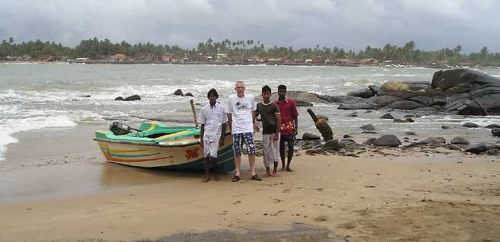
73 de Gerd DL5AWI

Donnerstag, 19. Februar 2009

R450KB - Kabardino-Balkarian Republik, Russia


This special QSL was received via the DARC bureau. The station was operated by members of the RK6XWA-club station.

The Republic of Kabardino-Balkaria is a federal subject of Russia (a republic), located in the Caucasus region.
History:
As with other parts of the Caucasus, the area that is now known as Kabardino-Balkaria has been inhabited for thousands of years. The origins of its inhabitants are somewhat obscure. The Kabards are known to have settled there by the 9th century, but it is not known when the Balkars arrived.
The region came under the control of the Mongols between 1242-1295. It passed into the hands of the Georgians from 1295 to 1505 before falling, briefly, into the orbit of the Persian Empire between 1502-1516. It was then ruled by the Ottoman Empire from 1516-1557. From 1557, it became a protectorate of the expanding Russian state – first Muscovy, then the Russian Empire. The lowland-dwelling Kabards allied themselves with the Russians, but the mountain-dwelling Balkars resisted the Russians for many years.
photo ©wikimedia
For the occasion of 450 years of protectorate of the Russian Empire the special station R450KB was running in Kabardino-Balkaria.
73 de Gerd DL5AWI

Mittwoch, 18. Februar 2009

VK9DWX - Willis Island, Australia

Today I received two different QSL-cards from the great expedition VK9DWX via the GDXF direct. This was a Dxpedition from the Bavarian Contest Club (BCC) and the result was 95178 contacts with radio amateurs worldwide.
Pictures about this awsome expedition are here
Willis Island is located beyond the Great Barrier Reef in the Coral Sea about 450km east of Cairns, Queensland, Australia.
While a staff of four people operates a weather monitoring station on the south Islet, Mid Islet and North Cay are uninhabited.
Meager vegetation with small bushes and grass, a lot of boobies, swallows and frigate birds, some crabs and by nightime also green turtles is all what you will find on these lonesome islets. With a diameter of 250m Mid Islet offered the team enough space to build up the camps and antennas

A soundfile with signals from Europe recorded at Willis Island are here
This was the super antenna farm:
160m V160E
80m 4-Square & V80E
40m 4-Square
30m 4-Square
20m 4-ele Vertical Dipole Array
17m 4-ele Vertical Dipole Array
15m 4-ele Vertical Dipole Array
12m 4-ele Vertical Dipole Array
10m 4-ele Vertical Dipole Array
6m Yagi
HF9 as spare antenna and for Pactor link
Two beverages for the low bands(EU & NA, short and long path)
73 Gerd DL5AWI

Montag, 16. Februar 2009

4S7PAG - Barberyn Island, Sri Lanka

Joel, F5PAC was in Sri Lanka, activated and operated as 4S7PAG from Barberyn Island, which count for the IOTA AS-171 for Sri Lanka's Coastal Islands group, from around 08oo UTC on 21 July until around 02oo UTC on the 23rd 2005.
This was a lighthouse activity also and count as SLI-002 for this program.
Sri Lanka, officially the Democratic Socialist Republic of Sri Lanka, known as Ceylon before 1972, and as Taprobane in ancient times, is an island country in South Asia, located about 31 kilometres (19.3 miles) off the southern coast of India. It is home to around twenty million people. The country is a multi-religious and multi-ethnic nation.
photo © F5PAC
Joel acrossed the ocean from Beruwala doing the near 1km boat ride. There is no freshwater on the island that is drinkable and the light house from British days manages with rainwater caught off the roof stored in tanks underground. So he carried the drinking water and food.
A short sound-file is aviable here
The following islands nr Colombo count for AS-171:
* Analaitivu * Barberyn [ AKA Beruwala ] * Kachchativu
* Nainativu * Delft * Iranaitivu
* Palaitivu * Punkudutivu
73 de Gerd DL5AWI

Sonntag, 15. Februar 2009

OX/PA3EXX/p - Rathbone Island, Greenland

The operator Johan, PA3EXX was 4 days on air from Rathbone Island, Greenland in August 2007. The IOTA number is NA-243 Greenland`s Coastal Islands North East. I received the card for my call DL5AWI via the bureau.

Rathbone Island located about 2 hours sailing from Ittoqqortoormiit, a small Inuit settlement. The transportation to the island was arranged by Nanu-Travel which is the local tourist office in Ittoqqortoormiit, owned by a group of hunters from the village.
During this operation, Johan make about 2600 contacts on 20 meter band in CW and SSB with all 6 continents.
Rathbone Island, Johan said, with the scenery of mountains, mist, ice-bergs, glaciers, whales, seals, foxes and rabbits, is a truly beatiful place. In winter the island can be reached by dog-sledge from Ittoqqortoormiit.
The equipment was used a tranceiver Kenwood TS-50 and as antenna a Force 12XK-40 dipole. A small generator used as power-supply and 2 spare batteries were beeing kept fully-charged in case of emergencies. Some awesome photos about the expedition are here!
73 Gerd DL5AWI

Samstag, 14. Februar 2009

OA4BHY/3 - Isla Blanca, Peru

This QSL was managed by one of the operators: Rene, DL2JRM.
I received the card via the DARC-QSL-bureau. This expedition was operated by Jorge: OA4BHY, Daniel: DL5YWM, Rene: DL2JRM and Jens, DL3ALF

Near the town Chimbote located the Isla Blanca (white isle, in English), that takes its name from the white color of the ground. This land measures approximately 3200 meters in length, 920 meters in width and about 204 meters in height.
Chimbote is the largest city in the Ancash Region of Peru. It is also the capital of the Santa Province and the Chimbote District. The city is located on the coast in Chimbote Bay, south of Trujillo and at 420 kilometers north of Lima in the North Pan-American highway.
photo © OA4BHY
This expedition to the Isla Blanca count for the IOTA-award as SA-074. This was a lighthouse activity also: ARLHS PER-040!
73 de Gerd DL5AWI

Donnerstag, 12. Februar 2009

GM2Z - Isle of Islay, Scotland

In the recent IOTA contest 2007, I worked with GM2Z. The crew was portable on the Isle of Islay, IOTA EU-008

Islay is the most southerly of the Hebridean islands off the west coast of Scotland. It is approx 25 miles long north-south and approx 20 miles wide east-west, it has approx 3.500 permanent residents.
Islay is famous for its excellent Islay Single Malt Whiskies from the eight working distilleries. Islay is very popular among birdwatchers. There are a number of important historic sites included several Celtic crosses and Finlaggan, home to the Lords of the Isles. Islay has a number of beautiful beaches as well as some impressive cliffs.

Mittwoch, 11. Februar 2009

FO/ON4AXU - Marquesas

Gerard ON4AXU send me the QSL via the DARC-bureau. His trip was 2004 around French Polynesia, Austral Islands and Marquesas Islands. Location on Marquesas was the Island Hiva Oa.
Hiva Oa, island beloved to the hearts of Paul Gauguin and of Jacques Brel, is situated 1184 km north-east of Tahiti. A tortuous geological formation endows the island with a wild and untamed atmosphere. Green valleys provide protection to some of the best archaeological sites in the Marquesas where you can see the largest tikis in Polynesia. It is also the most fertile island and considered to be the garden of the Marquesas. Atuona, the main village, nestles below the vertiginous cliffs of Mount Temetiu and Mount Feani.

Sonntag, 8. Februar 2009

TA1ED/0 Kara Ada Island, Turkey


This QSL card count as AS-098 for the IOTA-program. I received the card via the TA-QSL bureau. This expedition was operated by TA1ED, Metin and TA3FB, Baris on 80 to 10 meters band.

Kara Ada Island is a small Turkish island in the Bay of Bodrum in the Aegean Sea. It is a popular tourist destination, particularly for yachting.
photo © geir-ole
In the Middle Ages the island, which greeks name Arcos, was taken over by the Knights of St. John Hospitaller, who occupied also Bodrum. It was conquered by the Ottoman Empire in the XVI Century. In 1919 it was occupied by the Italians. The 1932 Convention between Italy and Turkey assigned it to Turkey.
73 de Gerhard Kaiser DL5AWI

Samstag, 7. Februar 2009

XF2K - Isla Larga, Mexico

This QSL-card came in via direct from manager N6AWD.
This expedition was operated by XE2K, XE2S, XE2WWW, N6JV and AB5EB in Februar 2007.

Larga Island is located in the Laguna Madra region of Tamaulipas State, Mexico.
It is a low island of sand and seashells wich makes it an excellent location for radio propagation.
The Laguna Madre is the name of two long, shallow bays along the western coast of the Gulf of Mexico in the USA and Mexico; the two being separated by the outlet of the Rio Grande. Meaning “mother lagoon” in Spanish, the Laguna Madre proper is 130 miles (209 km) long, the length of Padre Island; its biological corridor, though, extends well into Mexico, to the mouth of the Río Soto la Marina in the state of Tamaulipas.
13.4 % of the paticipants in the IOTA-program have confirmed the IOTA group NA-246. The coordinates are 22.25N - 25.95N / 97W - 97.85W
This island group contains the following islands:
* Barra Los Americanos
* El Carrizal
* Larga
* Los Bules
73 from Gerd DL5AWI

Freitag, 6. Februar 2009

9L1X - Sierra Leone

I was able to work 9L1X while operating from our contest location with better antennas.
QSL route was over the German DX Foundation GDXF.

The operators from Italy were Silvano/I2YSB, Vinicio/IK2CIO, Angelo/IK2CKR, Marcello/IK2DIA and Stefano/IK2HKT with three stations active on SSB, CW and RTTY.
The location was Sherbro Island with IOTA number AF-056.
photo © 2008 I2YSB
Wikipedia about that:
Sherbro Island, is an island in the Atlantic Ocean, located in Bonthe District off the Southern Province of Sierra Leone. The Sherbro make up by far the largest ethnic group in the island.
The island is separated from the African mainland by the Sherbro River in the north and the Sherbro Strait in the east.
It is 32 miles long and up to 15 miles wide, covering an area of approximately 230 square miles.
The western extremity is Cape St. Ann.
Bonthe, on the eastern end, is the chief port and commercial centre.
The island has over 65 miles of tropical beaches and has been earmarked by the Ministry for Tourism and Development of Sierra Leone for tourism development.
Sherbro Island is the site of an early 19th-century British post against the slave trade.
73 de Gerd DL5AWI

Donnerstag, 5. Februar 2009

YK9SV - Arwad Island, Syria


This card I received via the DARC QSL Bureau.
Arwad Island is the only island in Syria, and it is located 3 km from Tartus city. It was an independent kingdom named Aradus in the days of the Canaanites and was settled in the early 2nd millennium BC by the Phoenicians.
It was often mentioned in inscriptions because of this importance in commerce and seafaring.
Arwad is a beautiful small island, with a mass of houses and fortresses with narrow lanes. Its ancient citadel was used as a prison for the nationalists during the resistance against the French.

A team of 9 Greek ham radio operators activated the Syrian island of Arwad (AS-186) for the first time in the IOTA program, between November 1 and 13th 2007.
73 de Gerd DL5AWI

Mittwoch, 4. Februar 2009

9Q1NT - Democratic Republic of Congo

In the last bunch of bureau-QSL-cards was 9Q1NT, operated by Ghis ON5NT.
First information. The 9Q country is “Democratic Republic of Congo” (ex ZAIRE).
To avoid confusion with the Congo TN.


This was a operation from 9Q1EK station and friends 9Q1TB – 9Q1D – 9Q1NT, a staff member of the United Nations World Food Programme UN-WFP
Here a short story from 9Q1EK:
I would like all of you to know that it was far from easy to obtain an individual license in the Democratic Republic of the Congo.
I have been in the Rep. Dem. of Congo (ex ZAIRE) for 5 years. Throughout this period, the country has been at war. It has been divided into 3 rebel sectors (if you follow the press you should know). No ministry was operating correctly. Believe, me, it was a very bad period!
Every day we live with power failures that last for several hours, and the same goes for the water supply and it can be dangerous at night, in a city of 8 million inhabitants.
Just imagine, during a pile up with the power failure that we are not barefoot “ON AIR” with 12 vDC power and couple of candles!!!
Furthermore, here we have many time a QRN in the equatorial zone and without forget the cherry on the top of the cake......a big defectiv station transformer 350kv at about 800m of the shack!


photo © 2006 9Q1NT - Ghis

It took a lot of dedication to want to set up amateur broadcasting in 9Q. Take it from me: Gus (9Q1D - SM5DIC), Ghis (9Q1NT - ON5NT); Phil (9Q1TB - F5LTB) and myself (9Q1EK - VE2EK - ZS1II) have spared no effort.
Unfortunately, Ghis wasn’t able to play this call sign for long time.
It was so long to obtain that and he had to leave the country for other UN missions.
73 de Gerd DL5AWI

Dienstag, 3. Februar 2009

VU7SJ - Nicobar Islands / Lakshadweep Islands


Today I received the QSL from VU7SJ Nicobar Islands / Lakshadweep Islands for 20m/SSB.
This was a DX-pedition to celebrate Silver Jubilee celebrations of National Institute of Amateur Radio (NIAR), Hyderabad, the premier Amateur Radio organisation in India.
Members of this awesome expedition were also the german HAMs DL9GFB, OM Franz (VU3RYE)worked (Phone , CW)and DF7TT, OM Juergen (VU3NKW) (CW, Digital).
The amateur radio activity from the Island Agatti in the Lakshadweep group was a path breaking achievement for NIAR during the year of Silver Jubilee.

photo © 2008 Zipp01
Good operations from all the participants the dxpedition and good signals in all Bands.
73 de Gerd DL5AWI